大头花
都是些琐碎的小事。以后读起来,给自己找个乐子。


We left Takaka on the morning of October 17, it’s going to be a long drive today. We would follow the coast line down toward Westland National Park. The 600km drive would probably take 6-7 hours. The speed limit for most NZ highways is 100km, which drops down to 50-80 in towns. The enforcement is rather lax though. So far we have only seen one car pulled over by police, and we have seen a total of maybe seven or eight police cars since we arrived in New Zealand.
On the road to Punakaiki

We made a stop in Punakaiki, a town famous for blow holes and “pancake rocks”, layered sedimentary rock that looked like thin slices laid on one by one. The seams are actually softer material that got washed away more than the harder parts. As to why there are these softer layers sandwiched in between there are no definitive scientific explanation yet.
Layered rocks on the left looks quite different from those on the right

Tracy sitting on a pancake rock chair

A bridge formed when sea water carved away the lower sections

While traveling around, it’s very often to see rocks named after what people imagine that they look like. Sometimes the resemblance is there and you can see it right away. Other times it’s obvious that someone’s imagination ran wild.
We found this picture here. Compare this illustration of imagined shapes with the actual rock formation, can you see them as well?


Someone left a dummy here?

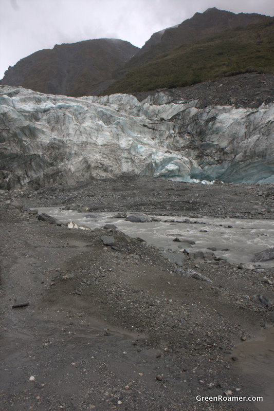
Westland NP has two main glacier attractions – Franz Joseph Glacier and Fox Glacier. We went with the latter because it’s slightly cheaper, less crowded, and from what I’ve heard, just as magnificent. It turned out to be a lucky choice. We found out later that there was a rock slide last week in Franz Joseph. The slide blocked part of the glacier, so there was only partial access to the ice. Lucky or not, here we are and ready to jump on the ice.
Fox Glacier is also the name of the town at the base of the glacier. It’s a small town mostly supported by tourism. There’s only one main company that does the glacier tours. The town has a small grocery store where we get our daily supply of kiwi fruits.
Our full-day tour started at 9. After we are fitted for equipment, we boarded a bus to the foot of the glacier. Two guides led our group. Scott, from Minnisota, and Jono, a kiwi. Each of them carries an impressive looking ice axe, and use them they do.
The ice near the lower section of the glacier looks quite dirty. Dust and pieces of rock brought down by water, dust storm and rock slide accumulate on the surface of the ice. Scott told us that once much of the glacier were painted orange by a huge red dust storm from Australia.
The lower right hand side of the ice face collapsed last night. Blue ice not yet touched by dirt can be seen there.
Face of the glacier
Clear blue and green glacier pool

Putting crampons on before climbing onto the ice

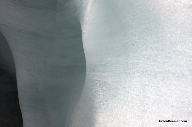
Beautiful blue ice

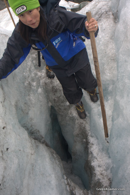
Tracy in an ice cave, everyone must get a picture taken here. It took a while

Climbing out from the other end, watch out for that guy

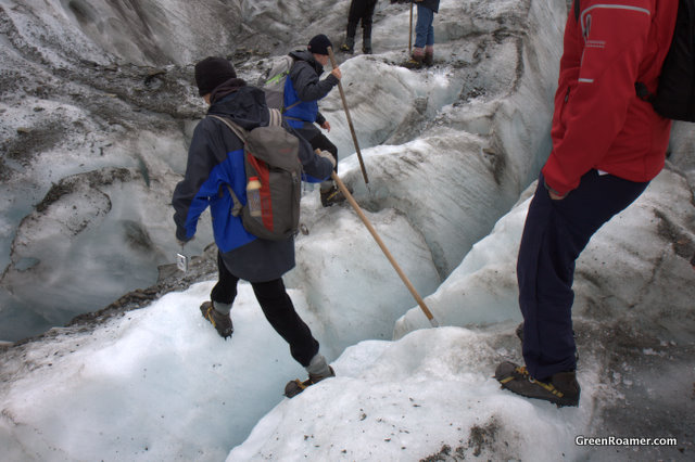
The surface of the glacier is anything but smooth. There’s gullies of all sizes cut by running water from the rain or melted by the sun. Some of the holes and gaps are filled with water. These are usually not too deep. The ice under out feet can be 200 meters deep. Falling into a sinkhole is not fun. Its the guides’ job to find a safe path across the ice.
A bit shaky crossing that gap
Tour guides like Scott and Jono only do part of the work. Because the glacier changes frequently from surface and ground streams, they also have a group of people whose job is to locate interesting ice formations and cut a clear path to them. This helped to make the tour more interesting – it would be quite dull to just walk on top of ice for 4 hours right?
Jono surveying a potential future attraction

Hiking past a small ice lake on top of the glacier

Another gap
Scott and Jono really putting those axes to use

Waiting to take a picture in front of an ice wall

Our group assembling

A smooth ice wall. Layers formed when snowfalls from different periods were compressed into solid ice
Patiently waiting for our hard working guides

Yes I can still see you. Now will you get moving?

Posing with Jono's axe

Taking a group picture. The jagged ice at our back is the upper limit of our trek.

Decending into an ice hole

Not a lot of space in here

Looking up from the bottom

Crossing a gap on our way back

Our valiant guides Scott (left) and Jono (right), really great guys

We spent four and half hours on the ice. It was even more fun than I expected. The crampons we put on our boots are very good. Mine never slipped on ice. I feel more sure footed walking on ice than walking on rocks. I want a pair of those if we are getting as much snow this year as last year in New Jersey.
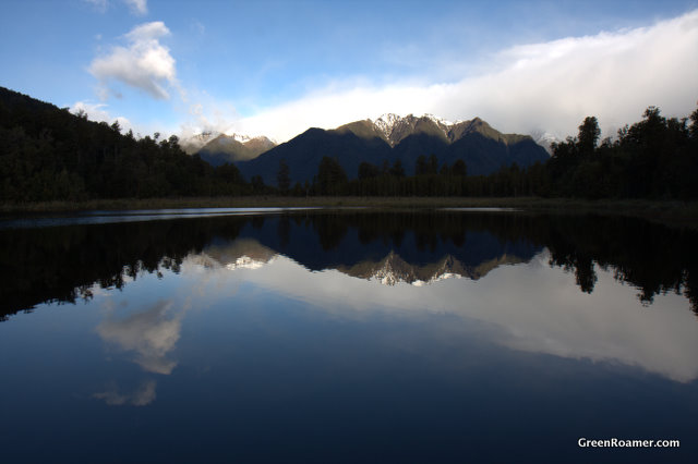
The day was still young when we got back in town. Tracy and I drove to Lake Matheson 8km out of the town. There’s an one and half hour trail around the lake which, when there’s no wind, offers postcard shots of snow capped mountains and reflections in the lake.
Fifteen minutes into the trail I was able to get a good shot. However, that was it, the wind picked up soon after. I can still get pretty pictures, but no more reflections.

Looks delicious huh?
Apparently this photographing location is legendary. While walking the trail we see groups of people hurrying toward the next photo spot, carrying cameras big and small. We met a woman 5 times at different spots on the trail. After patiently waiting for the wind to die down to no avail, she predicted that we’ll probably meet again here tomorrow at sun rise. Next morning we can hear the wind with window closed, so that didn’t happen.