


最新文章
文章分类
归档
2009 (364)
2010 (272)
2011 (195)
2012 (205)
2013 (210)
2014 (155)
2015 (172)
2017 (152)
2018 (173)
2020 (549)
2021 (771)
2022 (1090)
2023 (660)

正文
http://www.boston.com/bigpicture/2010/09/human_landscapes_in_sw_florida.html
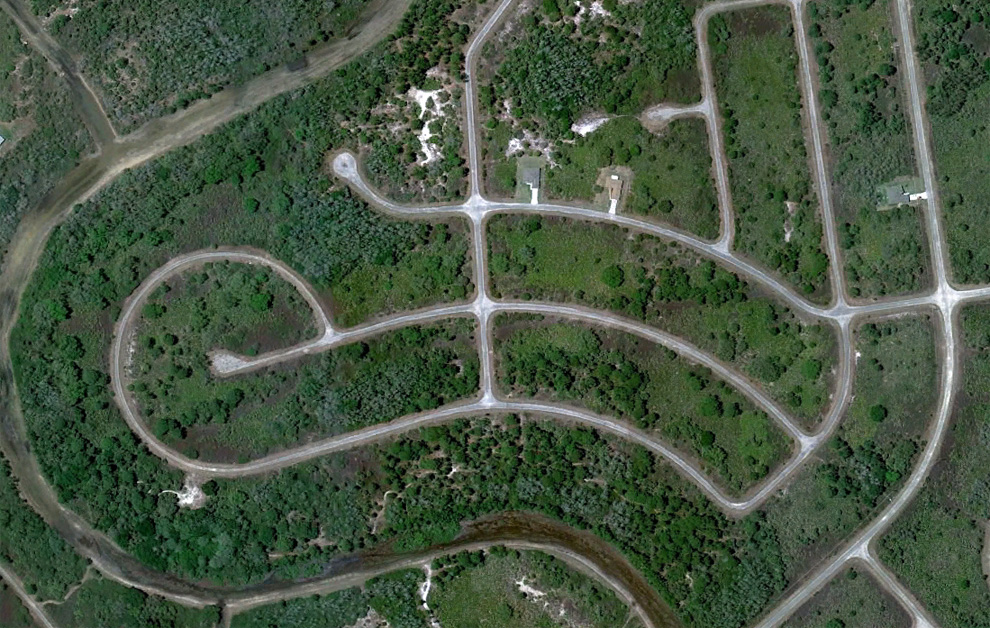
A section of a partially built residential project with only two houses in place, near Fort Myers, Florida. Map. (© Google)
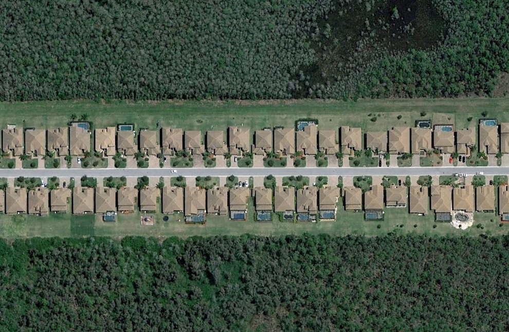
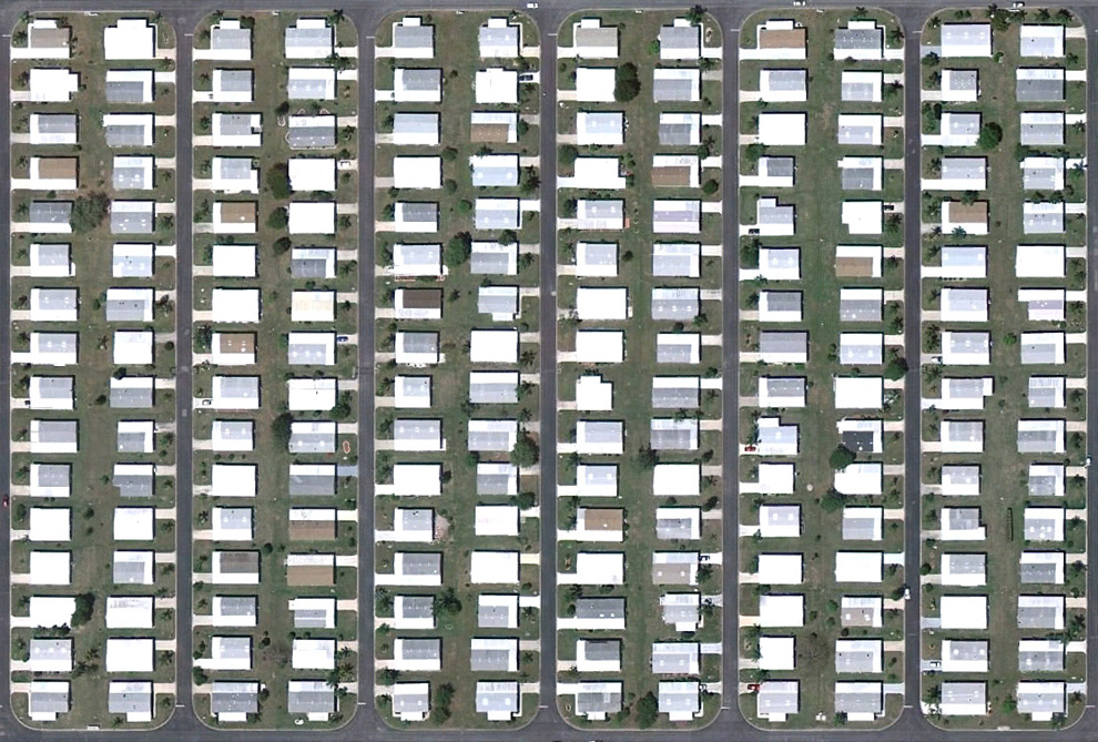
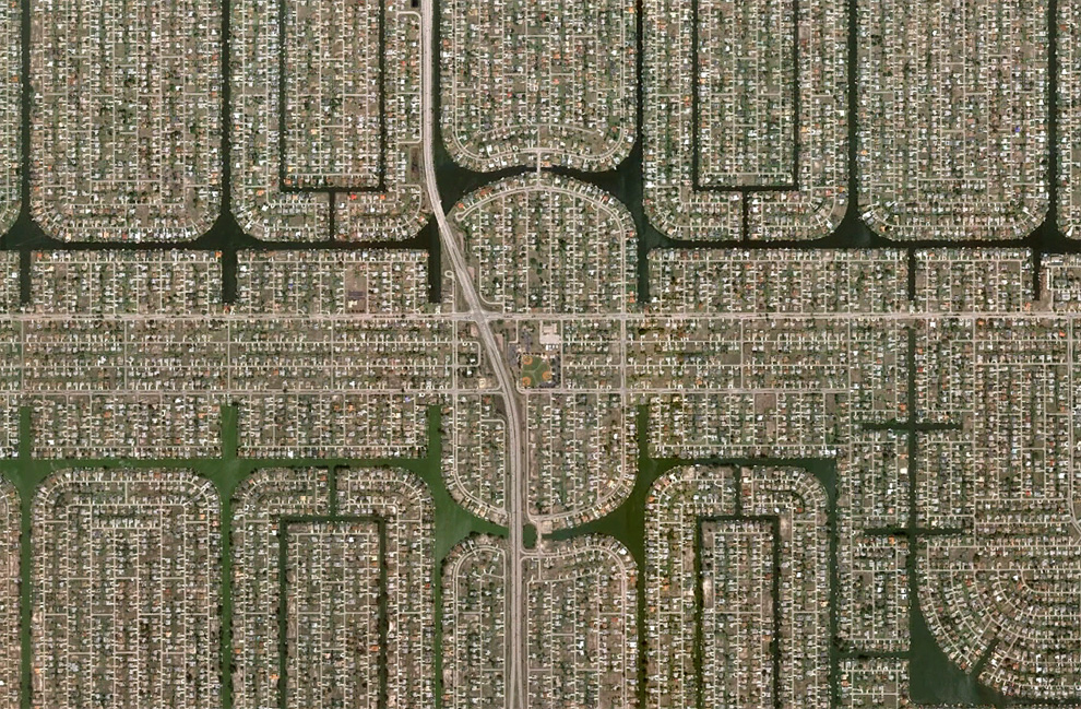
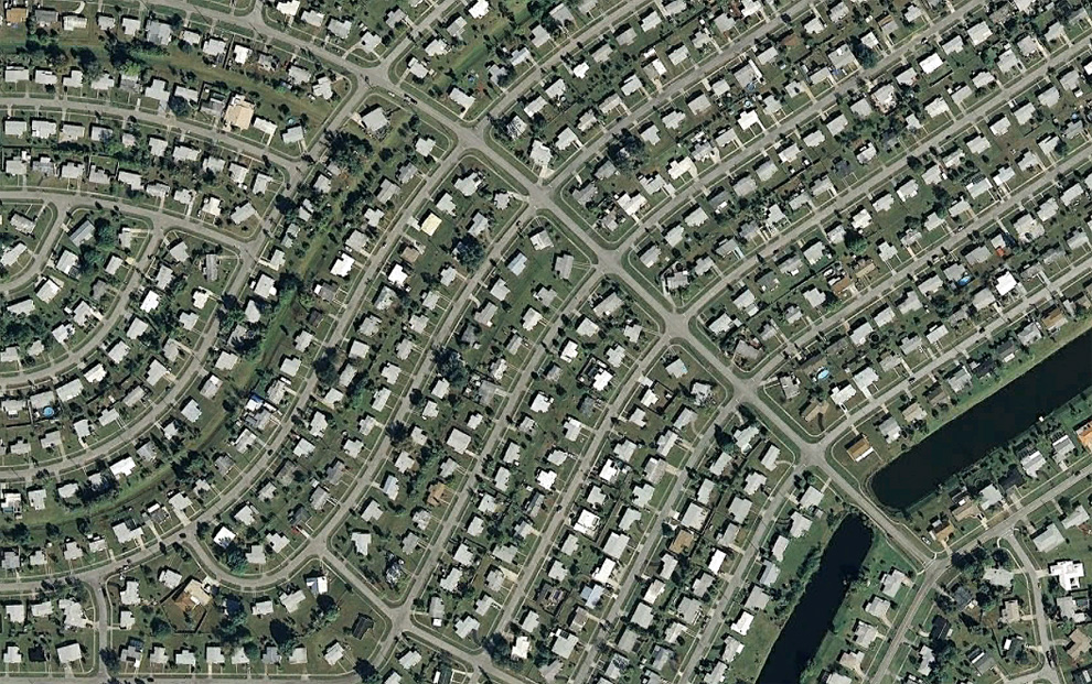
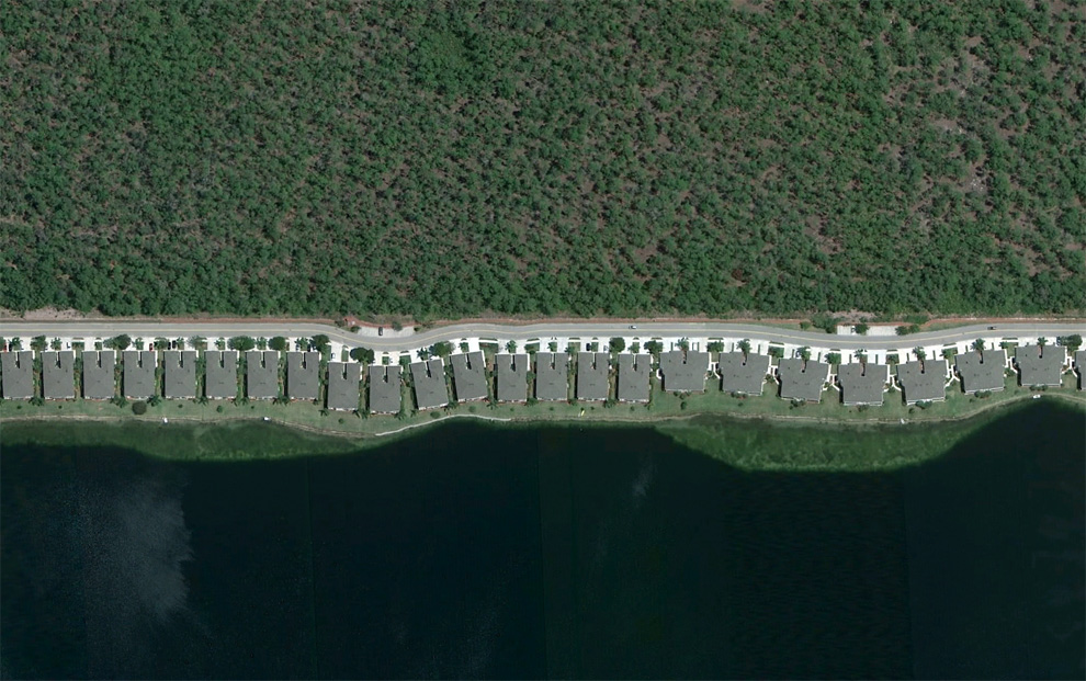
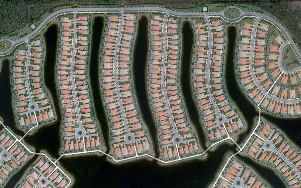
A strip of houses in a neighborhood southeast of Fort Myers, Florida. Map, Street View. (© Google) #
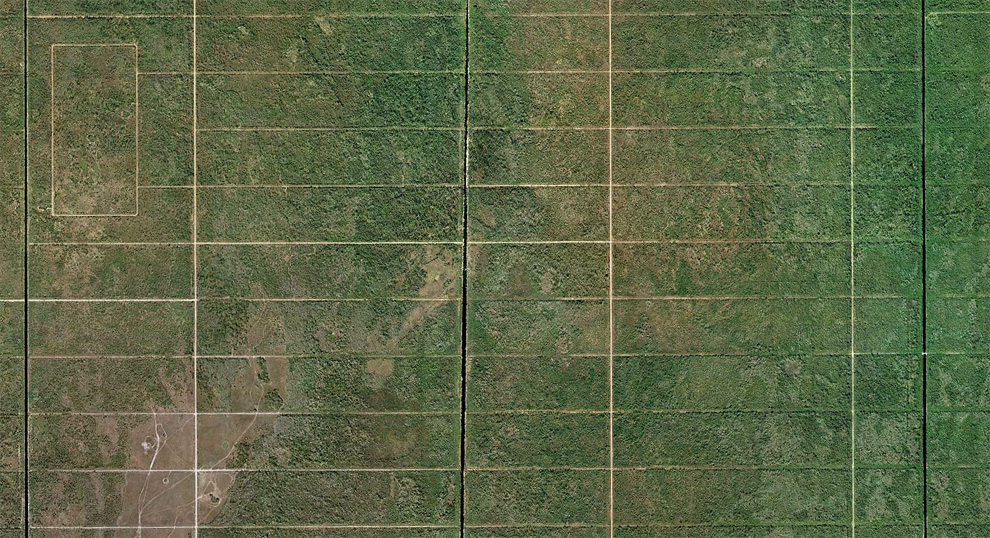
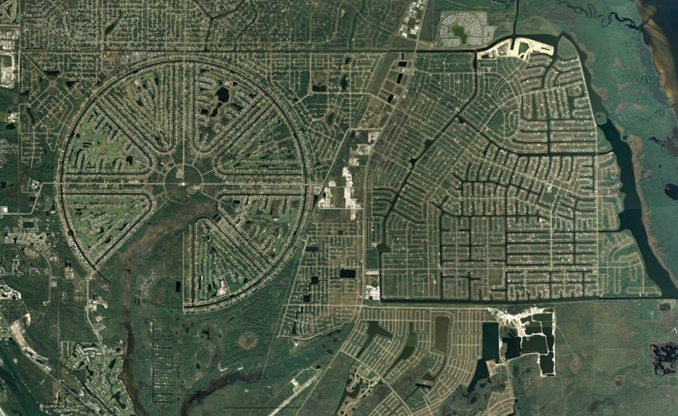
Once proposed as the 57,000 acre "Golden Gate Estates", this area was to be the largest subdivision in America in the 1960s. Many canals and roads were built, but the development eventually went bankrupt. Over the past 20 years or so, the land has been acquired by the state, and converted into the Picayune Strand State Forest. Map, Street View. (© Google/USGS) #
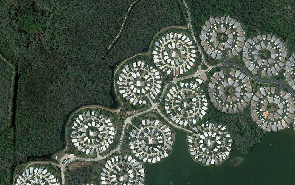
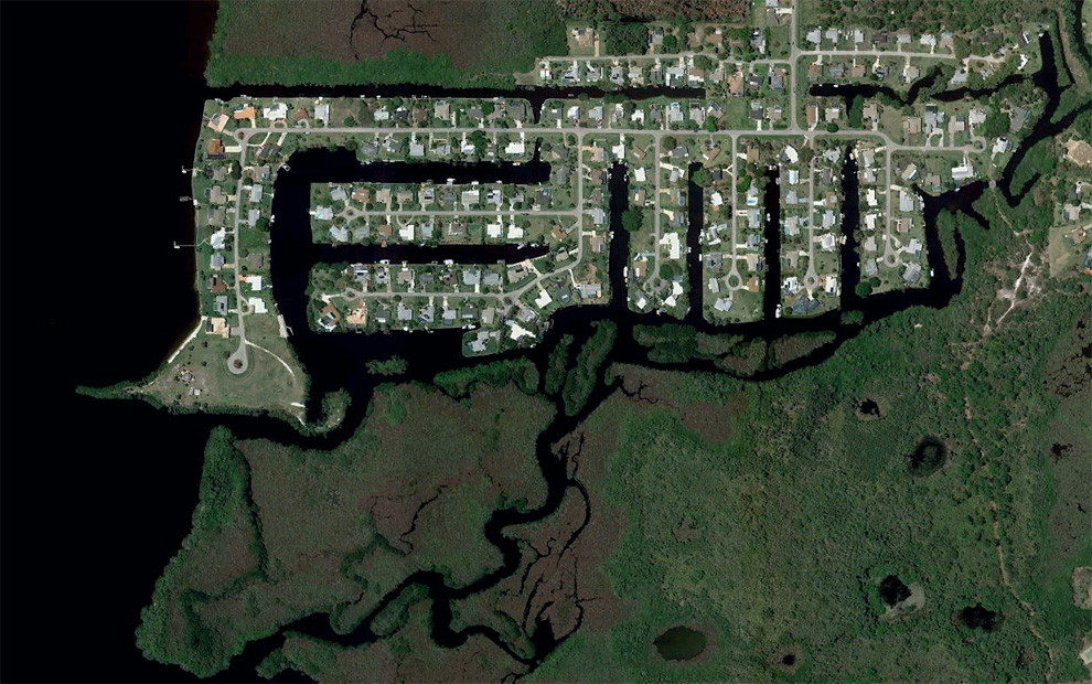
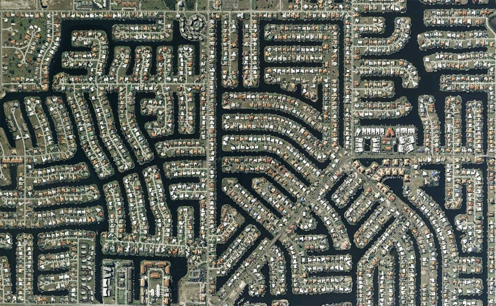
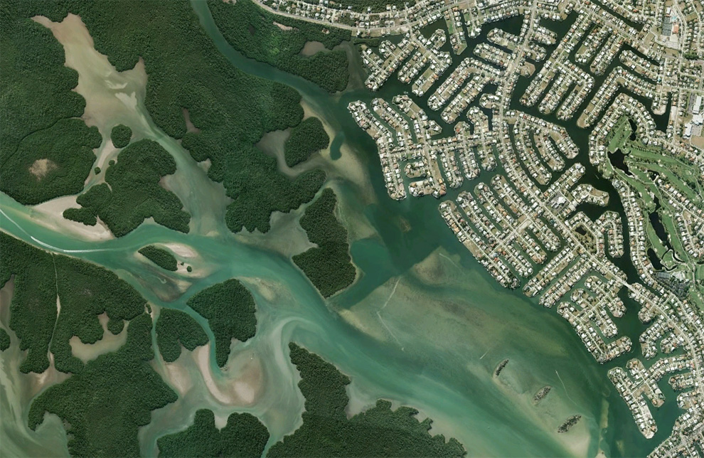
Boats make their way through canal structures in a neighborhood north of Cape Coral, Florida. Map, Street View. (© Google) #
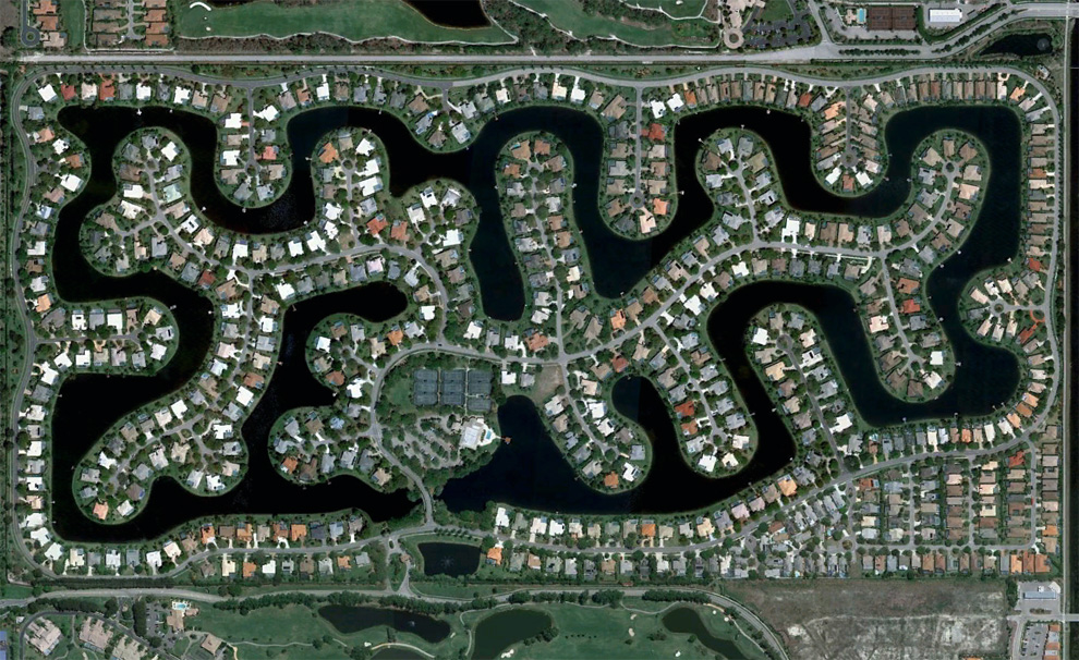
The Rotonda West neighborhood, originally developed in the 1960s, never quite fully completed, located in Charlotte County, Florida. Map, Street View. (© Google/Data SIO, NOAA, U.S. Navy, NGA, GEBCO) #
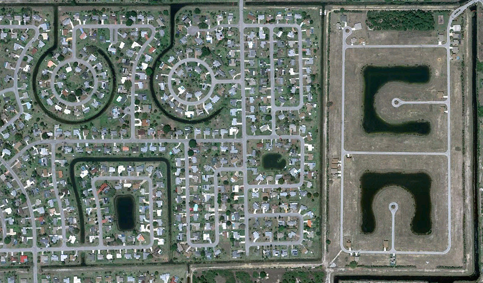
Empty cul-de-sacs fill an area south of Rotonda West in Charlotte County, Florida. Map, Street View. (© Google) #
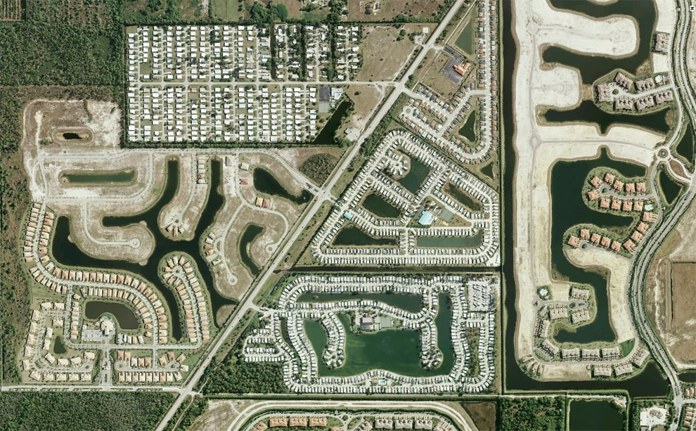
A development built near North Fort Myers Florida on the Caloosahatchee River. Map, Street View. (© Google/Europa Technologies) #
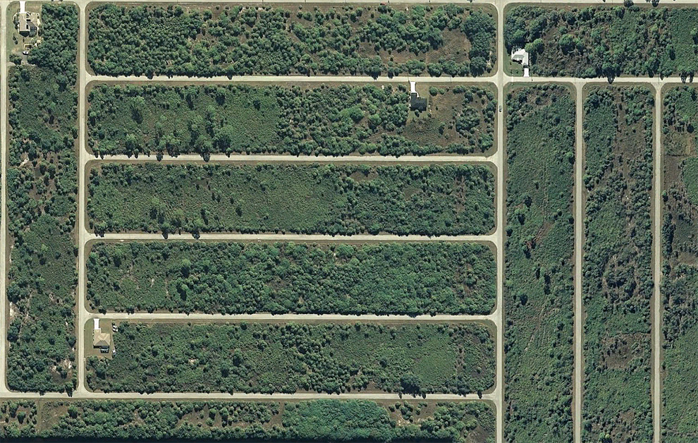
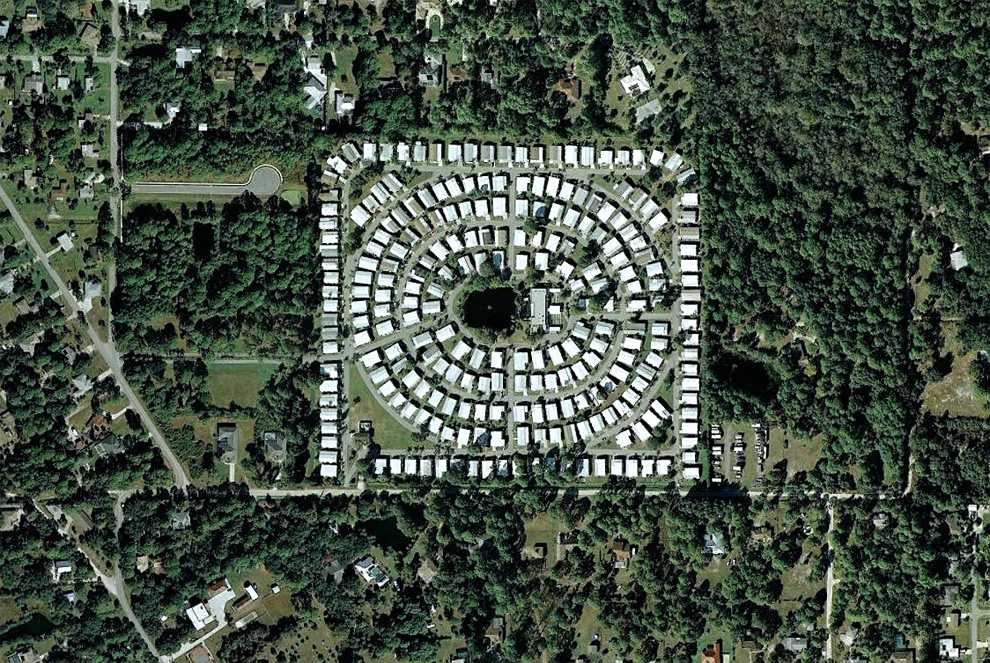
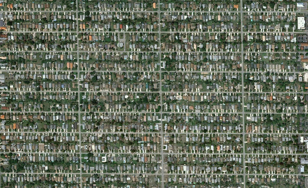
A partly developed, now partly overgrown neighborhood north of Lehigh Acres, Florida. Map, Street View. (© Google) #
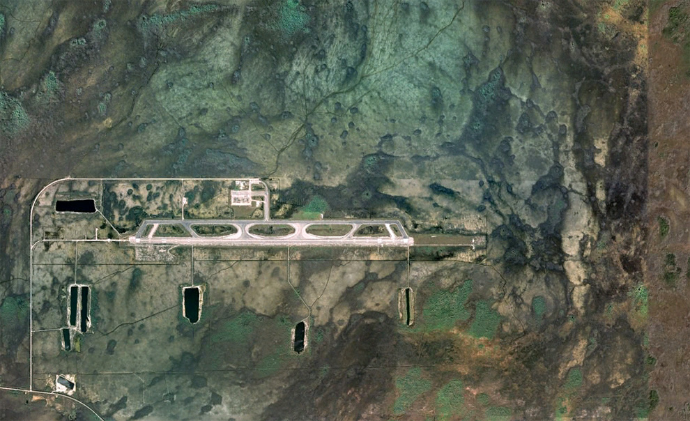
The Dade-Collier Training and Transition Airport was originally planned as the Everglades Jetport, and construction started in 1968 on what was to be the world's largest airport with six runways to support supersonic transport. Being surrounded by the Big Cypress National Preserve, environmental concerns halted construction, and when commercial supersonic transport didn't arrive, the project was left as-is, now a lightly-used airport. Map, Street View. (© Google/USGS/DigitalGlobe) #
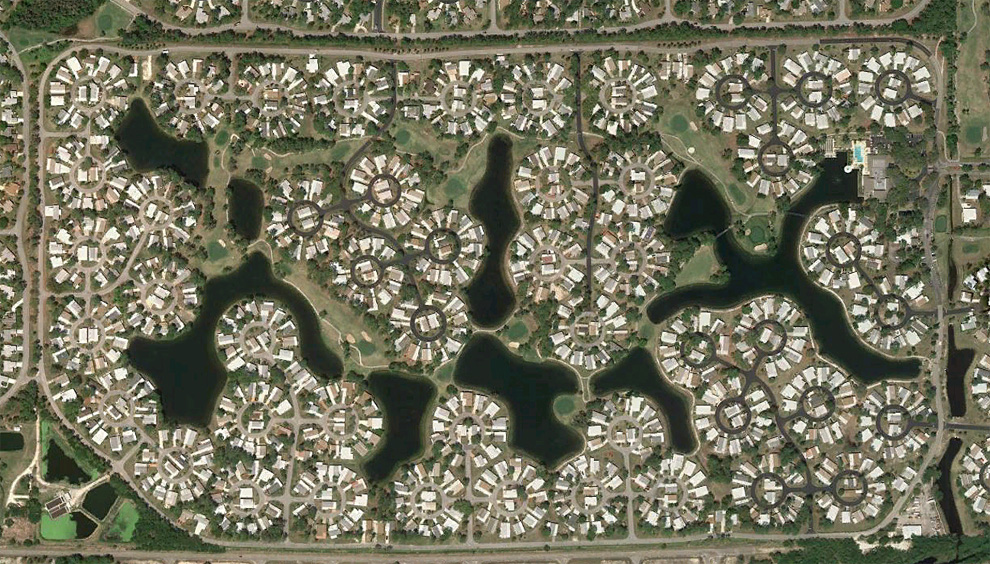
A partially-developed community near Charlotte harbor, north of Fort Myers, Florida. Map, Street View. (© Google) #
Canals and homes in Charlotte Park, south of Port Charlotte, Florida. Map, Street View. (© Google/Europa Technologies) #
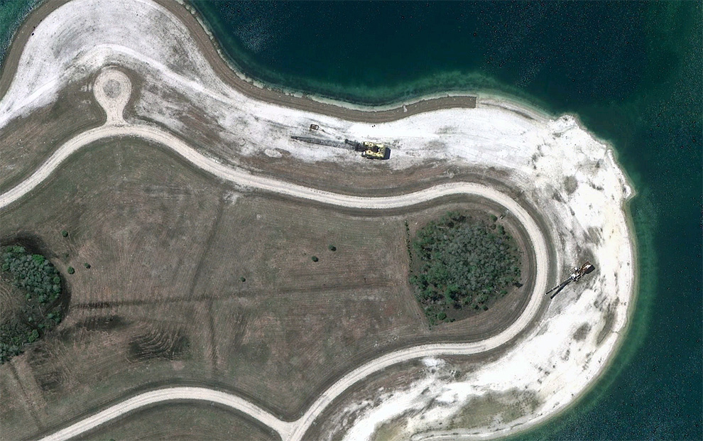
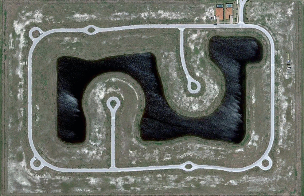
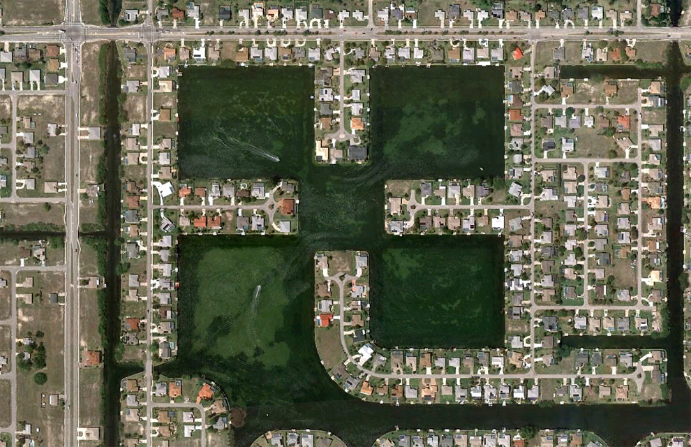
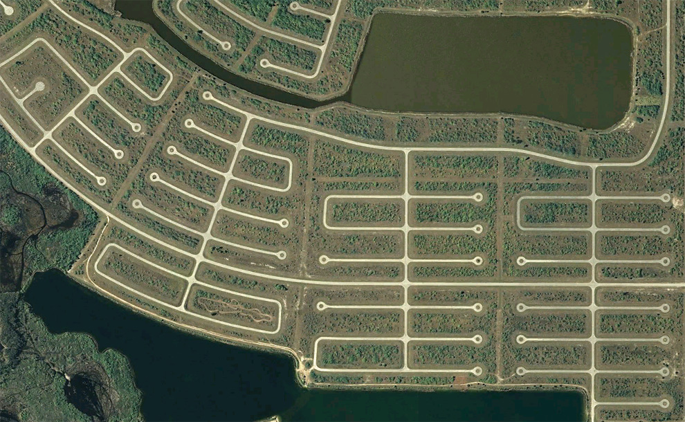
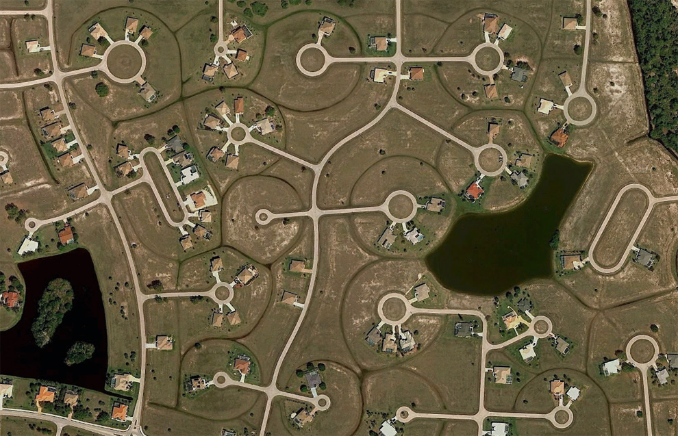
Construction equipment sits parked among empty cul-de-sacs and a man-made lake in a development southeast of Fort Myers, Florida. Map. (© Google) #
Human landscapes in SW Florida
A couple weeks ago, I was listening to a story by NPR's Planet Money team about "Toxie" a toxic asset they had purchased to follow and help tell the story of the recent financial meltdown. One of the mortgages in Toxie was on a home bought for investment in Bradenton, Florida, and the team took a look at housing in the area. Many homes there are empty and have been for years. Huge developments sit partially completed among densely built up neighborhoods and swampland. A guest stated that there were "enough housing lots in Charlotte County to last for more than 100 years". Boom and bust residential development has drastically affected parts of southwest Florida for decades now, and I spent some time (with the help of Google Earth), looking around the area. With permission from the fine folks at Google, here are a few glimpses at development in southwest Florida. (26 photos total)

评论
目前还没有任何评论
登录后才可评论.